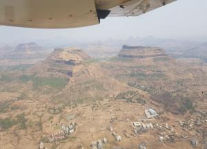
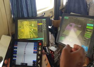
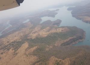
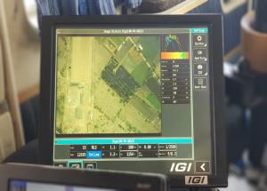
The LiDAR survey for preparation of detailed project report (DPR) for Mumbai-Nagpur High Speed Rail Corridor (approx. 736 km) started today, where an aeroplane fitted with state of art Aerial LiDAR and Imagery sensors took the first flight and captured the data related to ground survey.
National High Speed Rail Corporation Limited is adopting Light Detection and Ranging Survey (LiDAR) technology which provides all the ground details and data in 3-4 months wherein this process normally takes 10-12 months.
The ground survey is a crucial activity for any linear infrastructure project as the survey provides accurate details of areas around the alignment. This technique uses a combination of Laser data, GPS data, flight parameters and actual photographs to give accurate survey data.
During the Aerial LiDAR survey, 150 mtrs of area around the proposed alignment is being captured for the survey purpose. After the collection of data, Three Dimensional (3D) Topographical map of corridor of the proposed alignment on a scale of 1:2500 will be available for designing of the vertical & horizontal alignment, structures, location of the stations and depots, Land requirement for the corridor, identification of project affected plots/structures, Right of Way etc
To provide clear pictures of the structures, trees and other minute ground details,100 megapixel cameras are being used for the LiDAR survey.
NHSRCL has been entrusted to prepare the Detailed Project Reports for seven (7) High Speed Rail Corridors and LiDAR survey technique will be used for ground survey in all the corridors.
Additional details:
The proposed plan for Mumbai Nagpur HSR Corridor (approx 736 km) will connect Mumbai city with cities/towns like Nagpur, Khapri Deport, Wardha, Pulgoan, KaranjaLad, Malegaon Jahangir , Mehkar, Jalna, Aurangabad, Shirdi, Nashik, Igatpuri, Shahapur.


